Find Deed Records in Kaneohe
Kaneohe deed records cover a windward Oahu town with a mix of residential properties, bay-adjacent lots, and hillside homes backed by the Ko'olau Mountains. All deed recording for Kaneohe properties goes through the Hawaii Bureau of Conveyances in Honolulu, the single statewide recording office for all Hawaii islands. Property assessment and ownership data for Kaneohe parcels are managed by Honolulu County's Real Property Assessment Division under TMK Zone 1, the Tax Map Key zone covering all of Oahu. Whether you are searching for ownership history, checking a title chain, or reviewing prior transfers on a specific parcel, RecordEASE and the RPAD portal are the tools you need.
Kaneohe Overview
Deed Recording for Kaneohe Properties
The Hawaii Bureau of Conveyances (BOC) is the recording authority for all Kaneohe deed records. The BOC is in the Kalanimoku Building at 1151 Punchbowl Street, Suite 120, Honolulu, HI 96813. There is no windward Oahu branch. Every property transfer, mortgage, easement, or lien for a Kaneohe parcel must go through the downtown Honolulu office to be part of the official public record.
When a Kaneohe property sells, the deed must be recorded to give public notice of the ownership change. The base recording fee is $26 for the first five pages, and $5 for each additional page. Most standard residential deeds fall under five pages, but documents with legal exhibits or complex legal descriptions can run longer. The conveyance tax applies to every taxable sale and must be reported on Form P-64A. Exempt transfers use Form P-64B instead. Hawaii's conveyance tax runs from $0.10 to $1.25 per $100 of stated value. Kaneohe properties vary widely in price, from more modest residential lots to elevated hillside parcels with mountain and bay views that carry higher price tags.
The BOC website at dlnr.hawaii.gov/boc has the current fee schedule and all required forms. The legal basis for deed recording in Hawaii is HRS Chapter 502. Documents are indexed and made available through the RecordEASE system shortly after recording, and copies can be purchased at $1 per page.
Note: Marine Corps Base Hawaii (MCBH) occupies a significant portion of the Kaneohe Bay area adjacent to the town. Base housing and facilities within MCBH boundaries are not part of the standard deed record system for Honolulu County. Deed searches in RecordEASE for Kaneohe will only return records for civilian parcels.
RPAD Assessment for Kaneohe Parcels
The Honolulu County Real Property Assessment Division manages all property valuations for Kaneohe. The main RPAD office is at 842 Bethel Street, Basement, Honolulu, HI 96813, and can be reached at (808) 768-3799. The Kapolei branch office on the west side of Oahu serves that area, not Kaneohe. For Kaneohe property matters, the main downtown Honolulu office is the appropriate point of contact for in-person visits.
RPAD uses mass appraisal methodology to assign assessed values across the county. Mass appraisal is a systematic process of valuing groups of properties as of a given date using standardized procedures and statistical testing. For a town like Kaneohe, where topography affects property characteristics significantly, the mass appraisal approach captures broad value patterns by neighborhood and property type. A flat bay-adjacent lot and an elevated hillside parcel in Kaneohe have very different market characteristics, and the mass appraisal model accounts for those differences by applying location-specific adjustments to the baseline valuation formula.
When a deed is recorded at the BOC and ownership changes on a Kaneohe parcel, RPAD updates its ownership record for that parcel. The update can take a few weeks. If you look up a recently sold Kaneohe property in the RPAD portal and see the prior owner still listed, that is normal. The BOC recording date is the legal reference point for when ownership changed. Assessment notices go out in mid-December each year, and any appeal of the assessed value must be filed by January 15.
For Kaneohe property owners who want to check assessment data without an in-person visit, the RPAD portal at realproperty.honolulu.gov and the county's companion site at qPublic both provide current ownership and valuation information. The qPublic site updates ownership records weekly and billing data daily.
Searching Kaneohe Deed Records Online
RecordEASE at bocdataext.hi.wcicloud.com is the main online tool for searching Kaneohe deed records, providing access to the full BOC document index for all recorded property instruments on Oahu's windward side.
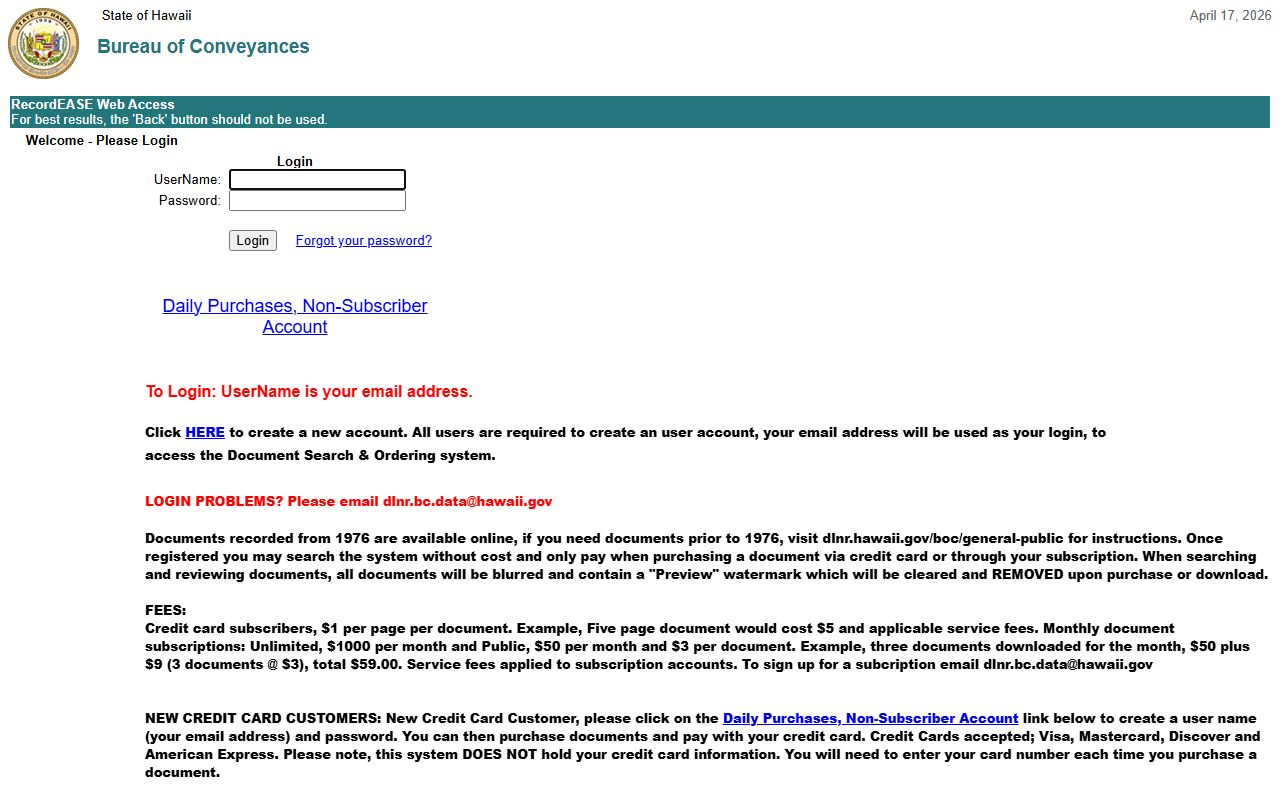
RecordEASE at bocdataext.hi.wcicloud.com covers all BOC-recorded documents from 1976 to the present. You can search by owner name, Tax Map Key, or document type. All Kaneohe properties use TMK Zone 1, since the town sits on Oahu. Filtering to Zone 1 prevents your search from mixing in records from Maui County, Hawaii County, or Kauai County.
Since RecordEASE doesn't search by address, start at the RPAD portal at realproperty.honolulu.gov. Enter the Kaneohe street address to find the parcel record and its full TMK number. Take that TMK into RecordEASE and run a parcel search. The results show every document filed against that parcel, each listed with document type, recording date, and parties. Purchase any document at $1 per page. Most Kaneohe deed searches can be completed this way without visiting any office in person.
For name-based searches, RecordEASE uses a last-name-first format. Enter the last name, then first name to match the grantor/grantee index. This is helpful when you want to find all properties a specific person has transferred in Kaneohe, either as a seller or a buyer. Adding a date range helps narrow results on common names.
Kaneohe Property Characteristics and TMK Searches
Hawaii's Tax Map Key system identifies every Kaneohe property as a TMK Zone 1 parcel in Honolulu County, with each lot assigned a unique key that links deed records at the BOC to assessment data in the county property system.

Kaneohe sits on the windward side of Oahu, facing Kaneohe Bay and backed by the Ko'olau Mountain range. The topography creates significant variation in lot characteristics even within short distances. Bay-front and bay-adjacent parcels offer water views and access; hillside lots in areas like Ahuimanu sit at elevation with mountain views. That physical variation means deed searches often turn up a wide range of property values and types within the same ZIP code (96744).
The Marine Corps Base Hawaii sits directly adjacent to the civilian town of Kaneohe. The base's presence is a backdrop for property searches in the area, but it doesn't complicate deed research for civilian parcels. Standard deed searches in RecordEASE using a Kaneohe TMK return only civilian property records. Base facilities and housing are federally managed and do not appear in the BOC deed index or the Honolulu County RPAD system.
Hillside properties in Kaneohe sometimes have deed restrictions or easements tied to slope stability, drainage, or access routes. These instruments are recorded at the BOC and show up in a RecordEASE search by TMK alongside the conveyance deeds. A buyer reviewing a hillside parcel in Kaneohe should check the full document list in RecordEASE, not just the most recent deed, to catch any access easements, drainage easements, or conditions attached to the parcel.
Bay-adjacent parcels may also have shoreline or flood zone considerations that show up in associated documents. While deed records don't directly report flood zone status, easements and plat notes tied to waterfront lots sometimes reflect these constraints. Checking the RPAD portal for any notes on the parcel record, then reviewing the BOC document list for the TMK, gives a more complete picture than either system alone.
Property Tax and Home Exemption in Kaneohe
Honolulu County tax rates apply to all Kaneohe parcels. The standard Residential rate is $3.50 per $1,000 of assessed value for owner-occupied homes. Non-owner-occupied properties with net assessed values over $1 million fall into the Residential A classification, with Tier 1 at $4.00 per $1,000 on the first $1 million and Tier 2 at $11.40 per $1,000 on the portion above $1 million. Kaneohe has a range of property values, with some parcels well under the $1 million threshold and others, particularly bay-view and elevated hillside homes, exceeding it. Whether Residential A applies depends on both the assessed value and whether the owner lives there as a primary residence.
The home exemption reduces the taxable assessed value for Kaneohe owner-occupants. Owners under 65 can deduct $120,000 from the assessed value before the Residential rate applies. Owners 65 and older get a $160,000 deduction. File the exemption with RPAD by September 30 for it to apply to the following tax year. If a Kaneohe property transfers and the new owner will live there, they must file a fresh exemption claim after closing. The prior owner's exemption does not carry over automatically when a deed is recorded changing ownership.
Tax bills split into two payments: August 20 for the first half and February 20 for the second. Online payments go through rphnlpay.com, which accepts Visa, Mastercard, American Express, JCB, and Discover at a fee of 2.25% plus $2.50 per transaction. Assessment appeals must be filed by January 15 after the mid-December notice arrives. Kaneohe's windward location and scenic characteristics mean assessed values can shift meaningfully from year to year as the market moves, making the appeal window worth monitoring for owners who feel the valuation has drifted from actual market conditions.
Note: Commercial and industrial properties in Kaneohe are taxed at $12.40 per $1,000 of assessed value. Hotel and resort classifications carry $13.90, and transient vacation rental properties are taxed at Tier 1 $9.00 or Tier 2 $11.50 per $1,000 depending on assessed value. These rates are set at the county level and apply uniformly across all Oahu communities, including Kaneohe.
Honolulu County Deed Records
Kaneohe is part of Honolulu County, which covers all of Oahu. All deed recording for Kaneohe properties goes through the state Bureau of Conveyances, and Honolulu County RPAD handles assessment and ownership records for the community through the TMK Zone 1 system that spans the entire island. County deed records resources cover Kaneohe alongside every other Oahu community under the same recording and assessment structure.
Nearby Cities
Kaneohe is on Oahu's windward coast, near several other communities that use the same Bureau of Conveyances recording system and Honolulu County assessment infrastructure for deed records.